

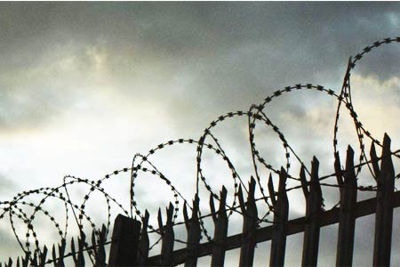
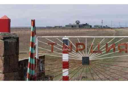
ArmInfo. The fact that the process of "defining" borders with Azerbaijan in the Syunik and Gegharkunik regions of Armenia does not proceed from the rule of law and contradicts the foundations of international law is also confirmed by rough socio-economic violations of the rights of residents of border villages, including the right to property.
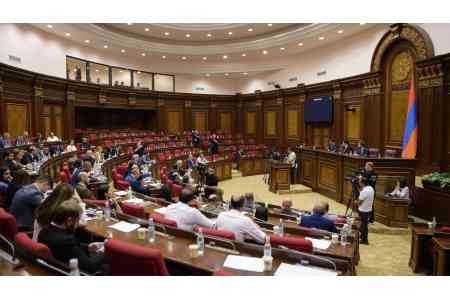
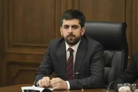
This is stated in the statement of the Ombudsman of Armenia Arman Tatoyan.
In this regard, the Ombudsman listed some of the problems that the residents of the villages of the Syunik and Gegharkunik regions of the Republic of Armenia face today. In particular:
1) the person has a legal document confirming the registration of his right to a house or land (for example, a cadastral certificate), but is deprived of this property, since it is physically considered "Azerbaijani" territory (for example, the village of Shurnukh, Vorotan, Syunik region).
2) a person has a document confirming his right to land, but he cannot, for example, use his land, because it is under direct fire of the Azerbaijani Armed Forces and, in addition, they regularly shoot (for example, the villages of Srashen, Shikaokh, Nerkin Hand , Aravus, Vorotan, Yeghvard, Agarak of Syunik region; as well as Kut, Norabak and in general almost all border villages of Gegharkunik region).
The same problem applies to publicly owned land and the possibilities for its use. 3) Land was allocated to a commercial company by the decision of the government, but the company cannot use it, since part of this particular territory is occupied by the Armed Forces of Azerbaijan (for example, the Sotk community of Gegharkunik region).
4) People were deprived of the opportunity to use pastures, meadows and gardens, because they are either under the control of Azerbaijan, or are under the target of their Armed Forces (all settlements on the border of Gegharkunik and Syunik).
“In response to these problems, some parties point out that since these decisions are based on topographic maps and in addition to the use of GPS and Google Maps, they should be taken anyway. In fact, international regulations take a completely different approach. Cadastral documents or cadastral maps should form the basis for the preparation of discussions and negotiations. They should form the basis of the starting (starting) positions of the parties.
According to international rules, cadastral documents related to the property rights of border residents, their lands and houses (even addresses) must be studied and registered in advance. It is necessary to calculate what possible problems people may have, and only then prepare for international or interstate discussions, "Tatoyan emphasized.
The Ombudsman continued that the key issue is that the process of border demarcation cannot disrupt the normal life of border residents, their traditional way of life and rights. According to him, the question here is not only about the rights to houses and land, but also to water resources, livelihoods and so on.
“It is also necessary to calculate all possible losses that a person or a person doing business may incur. All this should also become the subject of international negotiations and discussions. There can be no conditions for a person that disrupt his normal life in his own permanent place of residence just because his property rights were not taken into account due to some kind of interstate delimitation process.
The whole process should be organized in such a way that people do not have new problems, but on the contrary, all inconveniences are minimized. These rules are enshrined in the directives of the OSCE and the UN, in the decisions of the International Court of Justice and in the documents of other international organizations, "Tatoyan stated.


 Children from the regions of Armenia provide the local IT community with the largest library of cognitive biases
 Russian political scientist on Aliyev`s visit to Beijing: The Caucasus becoming much closer to China
 Iskandaryan: Any region seems larger and more important from the inside than from the outside
 Orientalist: Detention of Istanbul`s opposition mayor is Turkish president`s election ploy
  Issue of so-called `Zangezur corridor` will not be resolved in Armenia - expert
 IDBank Representative Joins the Editorial Board of Trade Finance Global
 Russian-Azerbaijani confrontation must not reach Armenia`s borders - MP
 Catholicos of All Armenians "in Pashinyan`s sights"
 Protesters outside Armenian government building demand prosecution of Pashinyan for his statements against AAC
 Catholicos: With Turkey`s military support, Azerbaijan committed a crime by forcibly occupying Artsakh
 Armenia`s premier insults clergyman on Facebook
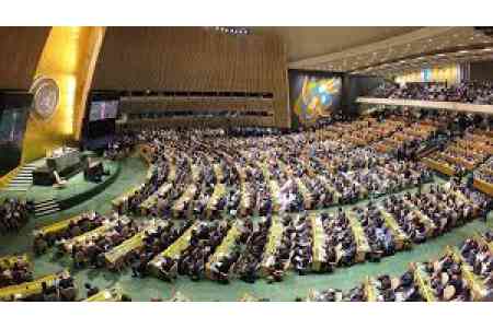 Armenia votes for anti-Russian resolution adopted by U.N. General Assembly
  Vardan Ghukasyan elected Gyumri mayor
  Armenian premier`s actions were aimed at surrendering Artsakh to Azerbaijan - MP
 Armenia`s premier sacrificed Artsakh to change Armenia`s strategic orientation - politician
  Prosecutor`s Office initiated a criminal case against Gyumri mayoral candidate Vardan Ghukasyan
 Democratic Alternative party condemns statement by ruling party`s Gyumri mayoral candidate about Artsakh
 Sixty U.S. representatives call on Secretary Rubio to end military aid to Azerbaijan
  Political scientist: After 31 years, Artsakh is recognized as part of Azerbaijan by Ter-Petrosyan`s political successor